Week ahead: a record warm start to October, then the Atlantic takes over
2026-10-02
October opened with summer numbers. On Thursday 1 October SMHI reported more than 20 degrees along the west coast, the first time since 2018 that Sweden has seen 20 in October. Göteborg reached 22.5 and Varberg 22.3, both new October records. SMHI put part of it down to föhn: an easterly wind sinking down to the coast warms as it descends.
Skåne got the edge of it. Hallands Väderö reached 21.4 and Helsingborg 21.1 on Thursday, Hörby 19.8 and Malmö 19.0. The normal day max in early October is about 14. Skillinge, out on the southeast coast with the wind coming off a cooling Baltic, stopped at 14.4. Malmö had already reached 21.5 on Tuesday 29 September.
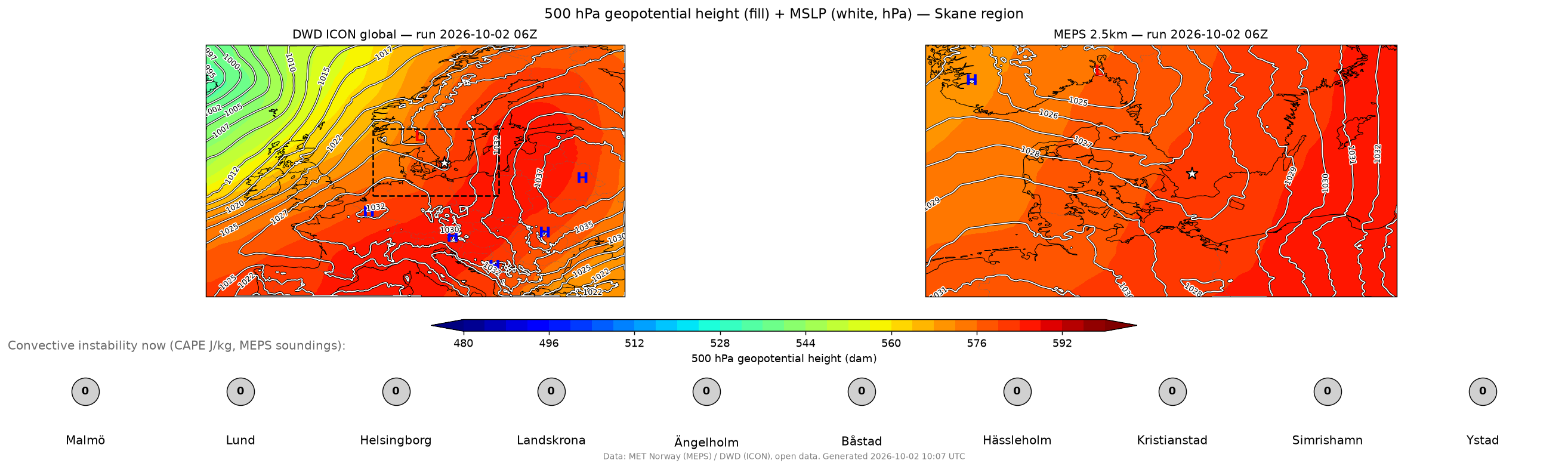
What is behind it right now: a large high over the Baltic states and western Russia, near 1037 hPa, with warm air aloft across most of Europe. Skåne sits on its western flank, in an easterly to southeasterly flow. Friday is cloudier, with a little rain moving through and a westerly turn.
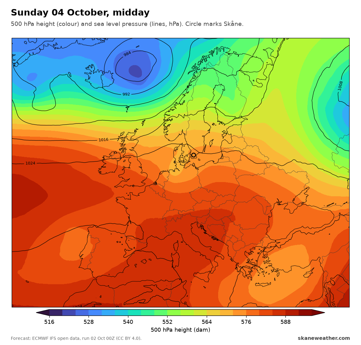
Weekend, 3 and 4 Oct: high pressure stays in charge, 1024 to 1026 hPa over southern Scandinavia. Mostly dry, sunny spells, light winds. Days 14 to 15, nights around 10 to 13. The cooler end of the run, but still about normal.
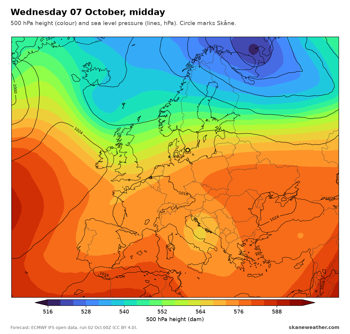
Monday to Wednesday, 5 to 7 Oct: the high slides away south and east and the flow turns westerly, with a low sweeping past well to the north, near northern Norway. Mild and damp: days 15 to 17, mild nights, more cloud (Monday the greyest), 1 to 2 mm of rain most days. Breezier from Monday.
Thursday into the weekend, 8 to 11 Oct: this is the change. A trough drops in from the northwest and a low deepens over the southern Baltic, below 1000 hPa just east of Skåne on Friday. Thursday is the wettest day in the run (about 15 mm in Malmö), then showers and a fresh northwesterly on Friday, with days of 12 to 15. Rain adds up to 40 to 50 mm over four days in this run.
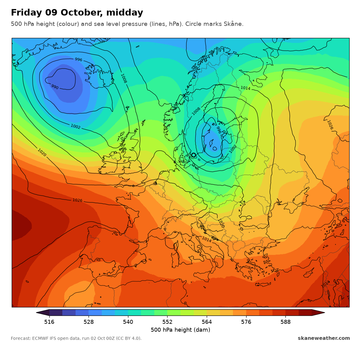
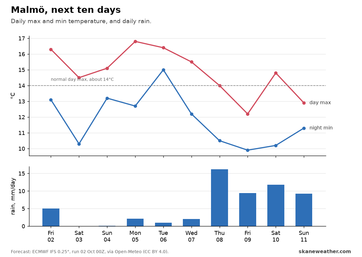
The second half of the week is one model run, a week out. The timing and track of that Baltic low will move from run to run. The sure part is the direction: from settled and mild to unsettled, windier and cooler. October in Skåne is getting back to normal.
Sources: SMHI blog 1 Oct 2026 and SMHI station observations (CC BY 4.0). Forecasts: ECMWF IFS open data, run 2 Oct 00Z (CC BY 4.0); MEPS (MET Norway) and ICON (DWD) open data.