October outlook: high pressure in the north, a dry lean for Skåne
2026-09-29
The ECMWF seasonal ensemble keeps high pressure parked over northern Scandinavia and Finland through October, the same blocking signal other seasonal models show. A block like this steers low pressure systems around it, south through the Mediterranean, and pumps mild southerly air into western Europe.
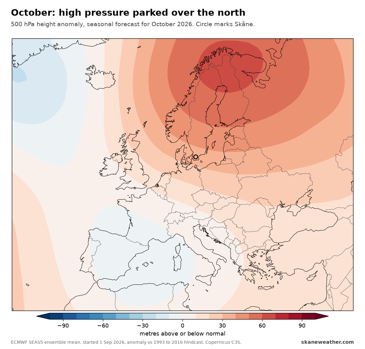
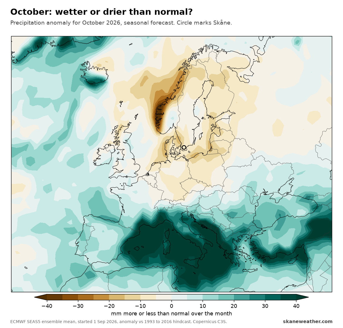
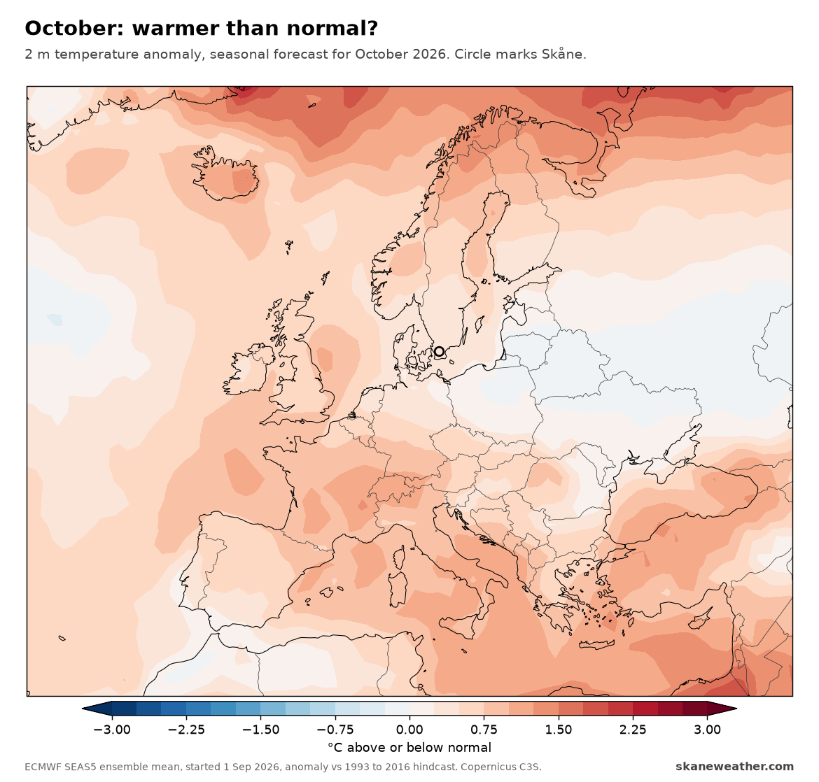
For Skåne the signal is modest. Temperatures come out close to normal for the month, about 0.3 degrees above, while rain leans a little on the dry side, roughly 8 mm less than normal over the month. The wet part of the picture sits far to the south, over Italy, the Balkans and Turkey.
A monthly outlook tilts the odds rather than promising a result, and this run was started on 1 September, so the next update in early October may shift it.
Sources: ECMWF SEAS5 ensemble mean started 1 Sep 2026, anomalies against the 1993 to 2016 hindcast, via Copernicus Climate Change Service (C3S).